|
|
Nikon GP-1 Review and first look
I received one of the first Nikon GP-1 units available
in Canada from the local rep and NPS (Nikon Professional Services)
Canada in mid December 2008. Sadly, I couldn't take it with
me to a wedding that I shot in January in Cuba as GPS units
are not allowed in that country.
However, I've recently had a chance to use the unit for a local
10 day long festival here in Winnipeg: Le Festival du Voyageur!
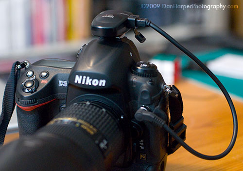
The Nikon GP-1 on camera
Setup and usage:
The unit is VERY simple to setup, in actuality you don't set
it up, you simply connect it to the 10 pin hole connector on
any Nikon DSLR, you then insert it in either the hot shoe connector
or it also comes with a plastic connector to attach it to the
camera strap.
After connecting it and turning your camera on it will take
a few seconds (5-20) to find satellites and then you're good
to go! It
will automatically record your GPS position into the EXIF data.
Surprisingly the unit also recorded data INSIDE several buildings
and tents. As long as the building had a couple of windows
the unit would still record the data and even be able to track
where I had moved inside, just like outside.
I've tested this unit on the Nikon D3X, D3, D300 and D200 and
it works perfectly on all of them.
The GP-1 is powered from the camera and is associated with the
meter directly. However there is an additional menu when the
GPS unit is attached to stop
the
meter
from turning
off when the GP-1 is connected. Without this option,whenever the
meter turns off
you have to wait for it to reconnect to the
satellites, although, reconnection is almost instant after it's
been active for a while.
There are also extra information screens which show you
your current position as well as the position each photo was
taken in.
Extra features:
The GP-1 comes with an extra connector socket to insert a Nikon
MC-DC2 cable shutter release, since your 10 pin hole connector
is taken up by the GP-1's cable.
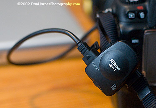
The Nikon GP-1 using the camera strap attachment (included)
Viewing and tagging your photos:
So, you've got GPS data in your photos, what now?
Nikon has a free program, Nikon ViewNX, that allows you to view all
of your GPS tagged photos directly within Google Maps. Simply select
the photos that you want to see where they where taken and go into
the "Image" menu and then select the "GeoTag" sub-menu. You will
then see a map, automatically zoomed to fit in all of your photos.
I was quite surprised at how accurate the viewer is, literally being
able to tell one photo from the next.
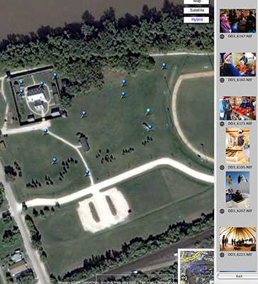
ViewNX example #1: Viewing only a few photos (Click for larger version)
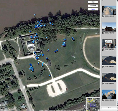
ViewNX example #2: Viewing multiple photos (Click for larger version)
For anyone who does lots of out of town trips, shooting landscapes,
lighting or starscapes or backpacking or canoe trips in rural areas,
this is a very good tool to have to be able to go back to the same
location.
|
|